При вводе Логина и Пароля,
обратите внимание
на используемый Вами
регистр клавиатуры!


|
|
|
|
|
Подсказка
|
||
|
При вводе Логина и Пароля, обратите внимание на используемый Вами регистр клавиатуры! |
||
|
|
|
|
| Добро пожаловать ! | Войти в Клуб Mountain.RU |
 |
|
|
|
 |
|
Mountain photos - amateur
and professional photos of mountains.
|
| Climb > |
|
Author: Maxim Foigel, Krasnodar
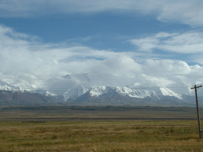
Lenin Peak.
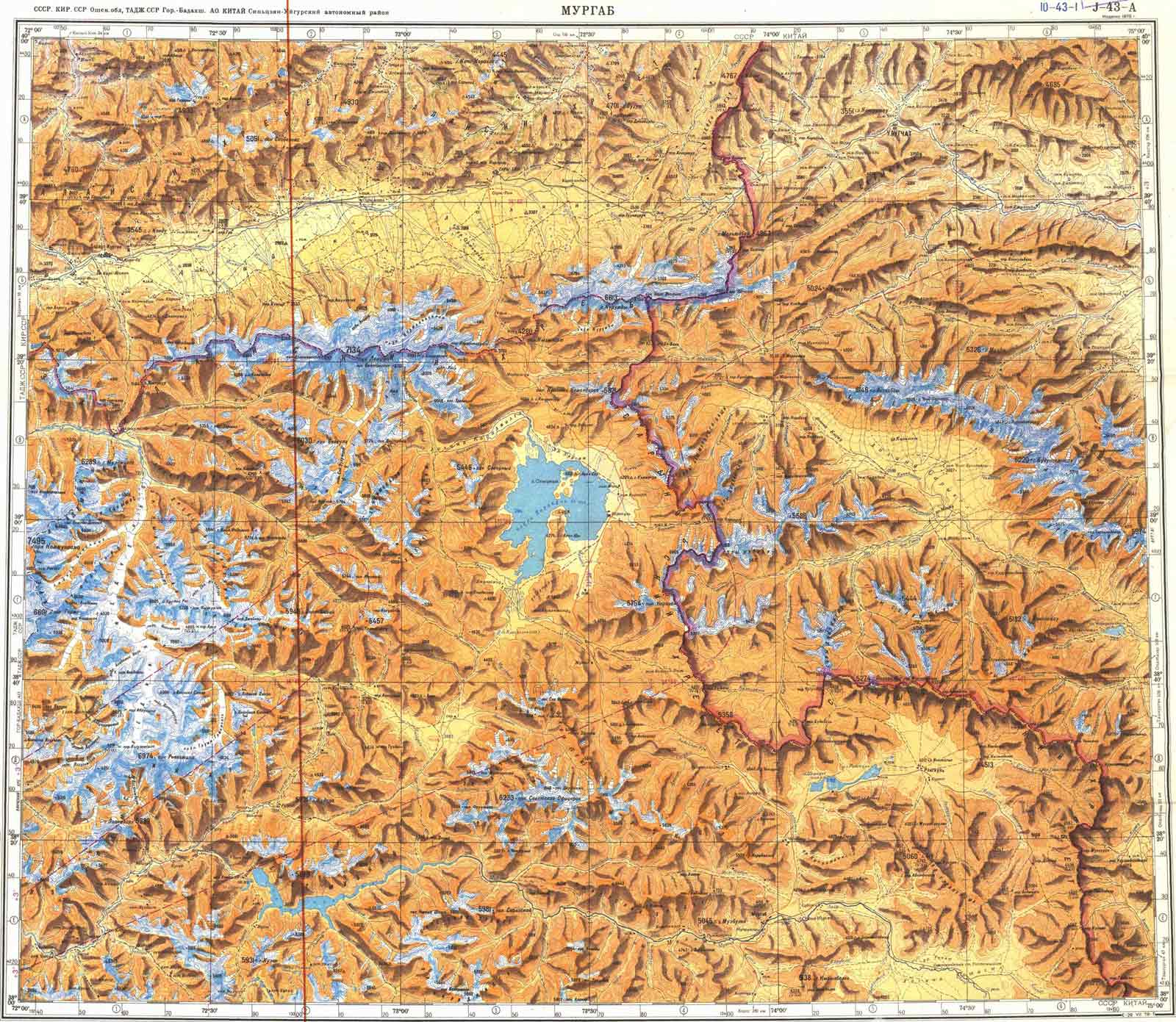
“…This summit was almost always covered with a cloud, and we had to look at it for a long time to make an opinion about its shape. There were no black points at all, everything was covered with snow. Later, from Alai , I saw that summit, and it seemed to be the highest one…” In such a way in 1871 one of the first Europeans that had ever got to the Alai valley – A. Fedchenko found the future Peak of Lenin . The summit he discovered was named the Peak of P. Kaufman . Nowadays the Peak of Lenin , exact altitude of which equals 7134.3 m above-sea level, is one of the most famous and often visited mount of more than 7000 meters high of the Pamir . In this article you will find information that can be useful for all the people who want to make a trip along the Zaalaisky ridge it contains the general deion of the region of the Peak of Lenin, the deion of climate features, geography, ways of approaches, the deion of one of the classical route to the top (along the Western ridge through the summit Razdelnaya), recommendations about necessary equipment and acclimatizing, and some more useful information. 2. Review of the region. 2.1. History.
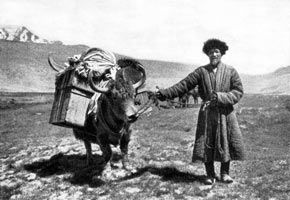
The beginning of the exploring of this part of Middle Asia dates from 1774-1782, when Russian captive Fillip Efremov, who was taken to slavery to Bukhara khanate, made his forced trip. Efremov went along the Fergana valley, via Osh , and through the passes Chigirik and Terekdavan came to Kashgaria and Karakorum . He had become the first European that crossed the Alai . Scientific exploring of the Alai started in 1871 when A. Fedchenko discovered the Zaalaisky ridge and its main summit. The first scientist, who reached the bottom of the future Peak of Lenin , was, probably, the famous explorer of the Pamir , N. Korzhenevsky. In 1928 united Soviet-German expedition for exploring the Pamir was organized. One of its aims was exploring the Zaalaisky ridge and its main summit that had been discovered by A. Fedchenko and was considered to be the highest point of the USSR . That year the Peak of Kaufman was renamed to the Peak of Lenin .
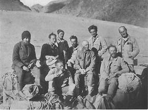
In September 1928, when main work of expedition was finished, German participants decided to make an attempt of ascent. The route of ascending had been established in summer. The alpinists were going to get to the upper course of the river Saukdara along the South slope of the Zaalaisky ridge. Having reached the source of the river, three German alpinists - E. Allwein , E. Schneider, K. Wien began moving along the glacier Big Saukdara. In 25 th of September 1928 they started climbing up from the saddle in the Zaalaisky ridge (the altitude of it equals 5820 meters , later it would be named the pass of Krilenko), and along the Eastern ridge at 15.30 they reached the top of the Peak of Lenin . In 1934 a new storm of the summit started, on that occasion it was going to be made from the North, from the canyon Achik-Tash in the Alaisky valley, along the Western branch of the glacier of Lenin. On the 8 th of September three alpinists: Kasian Chernuha, Vitaly Abalakov and Ivan Lukin, having passed the rocks that later would be named the Rocks of Lipkin, reached the top. In 1937 eight alpinists, leading by Lev Barkhash reached the top. That was the third ascent to the Peak of Lenin . In 1950 twelve alpinists of Turkestan military zone on the 14 th of August reached the top of the Peak of Lenin . It was the first ascent made after war. One of the most massive ascents was made in August 1967. Three hundred of alpinists reached the top. The ascent was dedicated to the 50 th anniversary of the USSR .
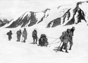
1968. That year was the year of records on the Peak of Lenin . In July parachute landing was brought to the region of the summit. Unfortunately, because of unpleasant weather conditions four people were lost. That year Valentin Suloev made the first descent by skis from the top of the Peak of Lenin . In 1972 in the valley Achik-Tash the first International Alpinist Camp (IAC) was organized. The year 1974 was unforgettable for many alpinists because of terrible tragedy that took place on its slopes. When making the attempt of traversing the Peak of Lenin eight alpinists perished (the leader of the group was Elvira Shataeva). It was almost the whole women alpinistic team of the USSR . The largest alpinistic tragedy of the history of this Peak took place in June 1990. As a result of earthquake from the slopes of the Peak of Lenin to the camp 5400 (“frying pan”) a powerful snow-ice landslip fall it killed 43 alpinists. That was the history of this Mountain. Certainly, those events are not all that happened on the slopes of that summit, but they seemed to be the most noticeable and, unfortunately, sometimes, tragic. And what the history of the summit in future will be like, time will show. 2.2. Geography. 2.2.1. Zaalaisky ridge. The Zaalaisky ridge, in the central part of which the highest point of it – the Peak of Lenin ( 7134.3 m ) is located, forms the Northern border of the Pamir . This ridge stretches for 150 km in latitudinal direction and in the East in borders upon the extreme western spurs of Kokshalatau (the Tien-Shan), and in the West in lends out near to the confluence of the rivers Muksu and Kizilsu. The Northern slope of the ridge is directed to the Alaisky valley, the Southern slope of it is directed to the Pamir . During rather long extension of the ridge, average altitudes of the Zaalaisky ridge exceed 6000 meters . On the East of the ridge, in the sources of the river Eastern Kizilsu a trapeziform summit Zaria Vostoka (“Dawn of the East”) ( 6346 m ) towers. To the right from it there is a giant snow massive of the summit Kurumda ( 6610 m ) – “Visible” in Russian. Some more to the right, in front of the settlement Sari-Tash the Peak Pogranichnik (“Frontier”) ( 5434 m ) is located. To the West from the Peak Pogranichnik the pass Kizilart ( 4280 m ) is situated, through which the Pamir highway is situated. The mountains of Korzhenevsky (the highest point of the range is 6075 m ) lie to the West from the Pamir highway. The snow range of the mountains of Korzhenevsky almost at the moment turns to the giant summit Kizilagi, or Red Stream ( 6679 m ). Beyond the Kizilagi there is the ridge of Barricades, and farther there is the Peak of Lenin . Beyond the Peak of Lenin there are three almost equal for their shape but different for their altitude summits – The Peak of Dzerzhinsky ( 6713 m ), the Peak of Krasin ( 5996 m ) and the Peak of Tsurupa ( 5996 m ). The last shape-pointed summit in the western part of the Zaalaisky ridge, towering looking like a correct trapeze, is the Peak of Sverdlov ( 5451 m ). These names were given to the mountains in 1928 by the leaders of the Soviet-German expedition: N. Gorbunov, N. Krilenko, O. Schmidt. Beyond the Peak of Sverdlov the Zaalaisky ridge is cut through by the valley Altindara, to the West from it and from the pass Tersagar the ridge went on stretching with noticeable raises with altitudes of mire than 5000 m . Near the western extremity of the ridge rivers Kizilsu (from the Alai valley) and Muksu (from the glacier of Fedchenko and Southern slopes of the Zaalaisky ridge) confluent, forming the river Surhob.
Modern glaciation of the Zaalaisky ridge is very considerable and takes its place after such large glacier centers as the glacier of Fedchenko (the Pamir ) and Inilchek (the Tien-Shan). Poor ruggedness of the ridge and its giant absolute altitude determined powerful modern glaciation. The Peak of Lenin serves as a center, from which the largest glaciers of the Zaalaisky ridge spread, forming the main junction of modern glaciation. The Alai valley (“Alai” means “paradise” in Kirghiz), spreading at the bottom of the Peak of Lenin, starts from the crosspiece Taukmurun (“Chicken Beak”), connecting by a small edge the Alaisky and Zaalaisky ridges. From the bottom of this ridge ( 3378 m ) it stretches for 135 kilometers , between foothills of both of the ridges, the valley enlarges from 8-10 to 20- 22 kilometers , all its square equals 1800 square kilometers. The extreme lower part of the Alaisky valley lies at the altitude of 2362 meters near the settlement Katta-Karamak. From the glaciers and snowfields of the Alaisky and Zaalaisky ridges the flows that confluent with the river Kizilsu, flowing along the Alaisky valley, streams. Beyond the ridge Taukmurun the source of the other river with the same name is located. This river – Kizilsu (The Eastern) – flows to Kashgary.
|
| Поделиться ссылкой |
|
|
| © 1999-2007 Mountain.RU Mail to: info@mountain.ru |
|