|
|
|
|
|
|
Mountain photos - amateur
and professional photos of mountains.
|
| Climb > |
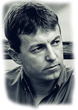
Author: Miha Rott Tomaz Humar and Ales
Kozelj to Aconcagua's Ljubljana, January 7, 2004 After failing to conquer the Himalayan mountain of Nanga Parbat in the summer of 2003, Humar was gathering fresh strength on less challenging mountains and climbing spots, where he was joined by mountaineer Ales Kozelj in October and November. Kozelj had been planning an expedition to Aconcagua together with mountaineer Matej Mosnik for quite some time, but unfortunately Mosnik had to give up his participation due to a knee injury. After two months of joint training, Humar and Kozelj were the ones setting out to South America. The expedition was once again made possible by Mobitel, Slovene national mobile telecommunications carrier and a loyal sponsor of Humar's endeavours.
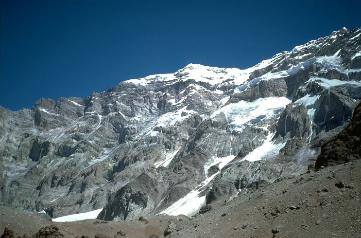
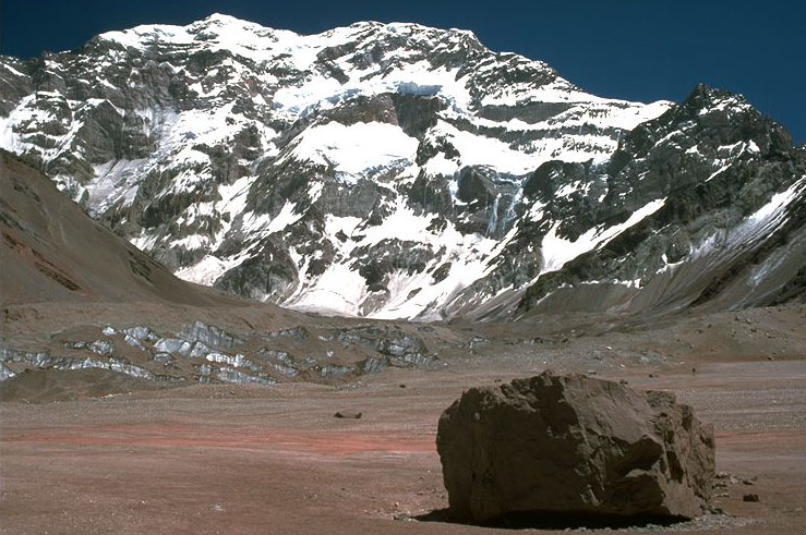
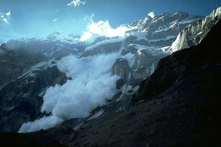
They left Ljubljana on November 26, 2003. Food and permits were acquired in a town called Mendoza, where they also rented all the equipment needed for their ascent. From Mendoza, their way led them to Plaza Francia at the altitude of 4.200 m, where they set up Base Camp. A fortnight of windy and stormy weather followed. During this time they climbed Aconcagua's glacier for acclimatization purposes, and for the same reason spent four days at the altitude of 5.600 m on a nearby mountain called Mirador. The weather cleared up on December 16. Humar and Kozelj moved up to camp ABC at the altitude of 4.400 m, and descended to the bottom of the glacier at 4.250 m the following day. They entered the face in the afternoon of December 17. They encountered falling rocks in the entrance passage, some of which hit Humar's shoulders, but luckily, he escaped with just a few bruises. The entrance waterfall was followed by a passage of black ice (a mixture of ice, falling rocks and water), then a 200 m crossing to the right over frozen soil, and from there a 50 m descent into a hollow of seracs. Since only frozen soil and receding ice could be found instead of steady rock, this part of the route represented considerable danger. They reached the bottom of the hollow by descending along the rope using Abalak. They continued their attempt across crevasses and seracs and ascended to the altitude of 5.300 m, where they dug a shelf alongside a waterfall and set up first bivouac B1.
On December 18, they continued their ascent across the black ice along the 'Black Pyramid' (approximately 500 m tall rock, situated inside a rock) and reached a passage between the seracs and the rock. That proved to be one of the most dangerous parts of the entire expedition due to falling rocks, ice and water; Humar was hit by falling water in the third stretch. Their path led them across a combination of ice and water, one of the most dangerous parts of the whole route, reaching the crevasses at the altitude of 5.700 m. They dug a shelf and set up B2 in one of them. On December 19, they continued their ascent up the 150 m high and in certain places slightly overhanging vertical waterfall. It was the first time during their expedition that they were hauling one of the rucksacks behind them. They were also affected by frostbite on this day. While the weather conditions worsened, they crossed the waterfall in a snow-blizzard and dug bivouac B3 at 6.100 m after covering three stretches. Because of the extreme cold they were facing, Kozelj suffered frostbite to his feet and hands. On December 20, they proceeded into the 'Small Bear' rock blockade, which was followed by a traverse some few hundred metres to the left. They climbed to the 'Swallow' or 'Traverse of Death' over a brittle rock pillar; crossing 300 - 400 m to the bottom of the 'Swallow' across snow, blown over an ice plate set at an angle of 60 - 70?. This attempt by itself contained great risk, as they were climbing roped up and unprotected. Once they reached the bottom, they found blown snow stuck to the rock, forming an approximately 15 m high pillar with no actual footing. They ascended to the top of the pillar and set up bivouac B4 upon ice-axes, rammed into brittle rock at the altitude of 6.300 m.
On December 21, they first descended back to the bottom of the pillar, from where they continued their journey across the technically most demanding part of the face, forming the other part of the 'Swallow'. This part consists of 100 - 120 m of overhanging rock barrier, which they were forced to climb with their bare hands due to high brittleness of the rock. During this part, they were hauling their rucksacks behind them once again. The barrier was followed by perforated black ice. A cold and windy day held another 200 m of combined ground (rock, ice) to the peak of the face. They concluded their route at the face's summit and connected it to the Sun line, set by Slavko Svetlicic in 1988. They set up bivouac B5 at the altitude of 6.750 m. On December 22 at around 12.30 a.m., they set out toward the 6.930 m high south peak, the conclusion of Slovene route from 1982. They reached the peak at 3.00 p.m. Two hours later they were standing on the main summit, where they stayed for another hour. It has been several years since Humar last climbed with a co-climber, so he and Kozelj agreed to name the route after both his former co-climber and his sponsor of many years, calling attention to the route's shape at the same time: Mobitel's Swallow - Johan's Route. They descended along the normal route on the north side of the mountain to Plaza del Mulas at the altitude of 4.300 m, which they reached in only two and a half hours at approximately 8.30 p.m. On December 23, they started their journey around the mountain on horseback. They reached Plaza Francia at 6 p.m. The next day they cleared up Base Camp and Camp ABC. During the following days, they returned to Europe via Mendoza, Santiago and Sao Paolo. They arrived to Ljubljana on December 28 at 11.30 p.m. Technical information on the route: |
| © 1999-2007 Mountain.RU Mail to: info@mountain.ru |
|