|
|
|
|
|
 |
|
Mountain photos - amateur
and professional photos of mountains.
|
| Climb > |
|
Authors: Konstantin Beketov, Saint Petersburg, Otto Chkhetiani, Moscow
Southern
part of Arctic Ural Review of tourist opportunities of the area Part 2 ( Part 1) Somkepaisky massif
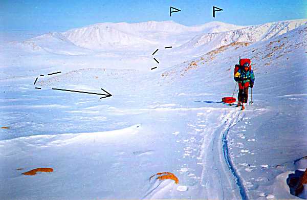
Further to the southwest Polar Ural is submitted by a number of plateau-shaped tops reaching on 20 km up to Bolshoy (Big) Khoilinsky pass. The most protruded summits are: Mt. Somkepai (1062m), 982 peak, Mt. Paity, Mt. Verkhnaya (Top) Khoila, Mt. Geographers and Mt. Dva Ozera (Two lakes). All these plateaux and tops can conditionally be called as Somkepaisky massif. A number of plateau-shaped ridges extend to the south from the prevailing tops. They split the valleys of the rivers Yambotyvis, Paityvis, Pravaya (Right) Paiera and Khoila. To the north from the main ridge the small arms dividing the sources of the Levaya (Left) and Pravaya (Right) Kechpeley diverge. Slopes of the plateau have irregularity cut by deep corries with a lot of lakes at the bottom them. The largest lakes: Yamboty-vis, Paity-vis, Verkhnaya Khoila. The passes Paity (1A, 910m), Verkhnaya Khoila (1Ŕ, 920m) are located to the south-west from Mt. Somkepay in the main range; in the north-west part of the plateau 1136m (Verkhnaya Khoila) there are Geographers (1B, 990m), Junjakhsky (n/c, 814m) located. Some passes through southern ridge spurs are investigated: Pervopaiersky pass (n/c, 814m), that extends from the sources of the river Pravaya (Right) Paiera to northern source of the river Khoila, and Uzel (Unit) pass (1B, 943m), that is located from the sources of the river Pravaya (Right) Paiera to the Paityvis lake. There are two ascent ways to summit Mt. Geographers: via Geographers pass, 1B, and from the north face via the long spur, that is located to the west from the western source of the Levy (Left) Kechpel river, n/c-1A. To the southwest from Somkepaisky massif the Ural range is cut with a wide through valley of the rivers Khoila-vis and Khoila. The valley is named as Bolshoy (Big) Khoilinsky Prohod (Pass) (n/c, 418m), and used by locals for a long time. Ancient deposits cut the bottom of the pass. There are a lot of lakes in the lows. During the season of strong winds the pass becomes a wind tunnel collecting winds from all neighbouring slopes and valleys because of its low arrangement and local orography that makes its through passage rather problematic. Khoilinsko-Lagortinsky massif To the southwest from Khoilinsky pass a strongly dissected Khoilinsko-Lagortinsky massif raises. It extends more than 20 km from the north to the south, and 18 km from the west to the east. The northwest part of the massif is represented by plateau-shaped uplift of Mt. Khoila-Vis. Its highest point is 1068m in the southern part. East slopes of the plateau represent deep corries with the walls of 400-500 m. From northern and western slopes of the massif of Mt.Khoila-Vis the rivers Malaya (Small) Kholayu, Pravaya (Right) and Srednaya (Average) Lakhorty originate. Mt. Khoila-Vis is separated from the main massif by a deep saddle of pass Srednelakhortinsky (also named Parallel, November) (1Ŕ, 890). The pass is very popular among ski tourists. From the east the saddle is limited by 1094.8m peak - the highest point of the massif. Truba (Pipe) pass (n/c, 800m) leads from a valley of the river Truba-Yu to sources of the left inflow of the river Khoila-Vis. To the east from the pass the 17 kilometre plateau-shaped a ridge is located (its maximum point 1013.6m). Through this ridge there is a potential pass from the right inflow of the river Khoila head. The route of its ascent passes via the northern edge gutter located to the north of the top of 871m and deduces through a wide saddle with altitude of 777.1m to the Truba-Yu head river. The pass 931.9m, n/c conducts from the head left source of the river Lakhortayu to the corrie of the river Khoila-Vis. You can get to this saddle ascending also from the head Lakhortaegart river through a plateau of Mt. Malaya (Small) Lagorta (1017.8m) or from the southern corrie of circus Srednelakhortinsky pass. There is another variant of ascent on the plateau from a narrow gorge of the left inflow of the river Lakhortaegart to the north of the top of 742.7m. Behind the valleys of the rivers Srednaya (Average) Lakhorta and Lakhortaegart, connected by a low saddle of Sredne-Lakhortinsky pass (n/c, 330m), the small massif of Mt. Obryvistaya (Steep)(836 m) rises. It extends 12 km from the north to the south. In average part of the plateau the saddle of pass Kanjonny (n/c, 570m), connecting the river Lakhortaegart and the river Srednaya (Average) Lakhorta with the Bolshaya (Big) Lakhorta lake, is located. Bolshaya (Big) Lakhorta lake is located in headwaters of the river Levaya (Left) Lakhorta to the east from the massif of Mt. Khordjuz. Levaya (Left) Lakhorta connects the left source of the river Bolshaya (Big) Lakhorta (east slope) through a saddle of Left - Lakhortinsky Pass (n/c, 448m). Khordjuzsky massif To the west from Bolshaya (Big) Lakhorta lake a small, but interesting Khordjuzsky massif is located. It extends only 7 km in meridian direction. The massif raises above a lake valley on 400-700 m. The main place of interest of the massif is Skalnaya (Rocky) mountain (1178m) with significant outcrops of rocks. The mountain has two tops of approximately equal altitude; the cairn is set on northern. The tops are connected by an openwork ridge with a lot of needles. Winter traverse of the tops represents very technical complex climb on the rocks covered with hoarfrost (3Ŕ). The simplest variant of ascent on the northern top leads via the northern slope from the foothill tundra (1B); you can ascend on southern top via a long southeast ridge from the valley of Bolshaya (Big) Lakhorta river (1B). The more complex routes conduct: via the east face (2B) or via the northwest ridge (2B) on the northern top; via the southwest ridge (2B) on the southern top. The route of ascent Mt. Khordjuz(1086m, n/c-1Ŕ) goes via a flat ridge from the saddle of 1020 m located to the north from the top in the head of northeast corrie. A saddle of the pass of 468,3 m (n/c) connects the area of Levo-Lakhortinsky Prokhod with the heads of the right source of the Big Lakhorta river and the bottom of the southeast ridge of Mt. Skalnaya. In a source of Big Lakhorta river one of the most beautiful and popular passes through a water-separate ridge of the southern part of Arctic Ural - Skalny (Rocky) pass (n/c, 540m) is located. Palnik-Shorsky massif Palnik-Shorsky massif is located the southwest and extended almost16 km from the south to the north. The central part of a range has alpine landscape pattern. The highest tops are: Palnik-Shor (1174,6m), Nedju (1157,1m), tops 1115m and 1004 m. In the central part of the range there are the passes: Sher-Shor (n/c, 680m) - between the tops of 967m and 1115m and Palnik-Shorsky (1Ŕ, 840m) - between the top of Mt. Palnik-Shor and the top of 967m. Both passes connect the western slope of the range - sources of the river Grube-Yu with the river Sher-Shor - a large left source of the river Malaya (Small) Lagorta. To the south from the massif of Mt. Palnik-Shor Palnik-Yu pass (n/c, 370) connecting the rivers Palniktyvis and Malaya (Small) Lagorta is located. Palnik-Shor massif has a significant glaciation in the corries of the east slope. It is connected with sources of the rivers Bolshaya (Big) Lakhorta and Sher-Shor by Zahrebetny pass (n/c, 680m). You can get to Palnik-Ju pass from the Sher-Shor river going through a saddle of 460m pass (n/c). One of the ascent routes on Mt. Palnik-Shor goes from Palnik-Shorsky pass via the northern ridge - 1Ŕ or from the valley of the river Sher-Shor head of the southern source - 1Ŕ. Karovy massif
To the south the seldom-visited heads of the rivers Paga and Pogurei, Kokpelskie passes (often used by locals) and adjacent to the main range Karovy massif are located. Karovy massif extends 25 km in meridian direction and 15 km from the west to the east. The maximum altitude is 1142m. The Mountains are sharply dissymetric here, breaking almost continuous abrupt wall to the west on all the extent of the massif, and smoothly losing altitude to the east. From the north Karovy massif is limited by a through valley of sources of the Malaya (Small) Lakhorta and Lakhortaegarta rivers. The pass altitude is 560 m. In the central part of the massif there are passes Petersburg (from the source of Paga to the source of Pagureya rivers), Petrograd (from Pagureya toVylia rivers) and Leningrad (from Ydzhid-Labakheishora back to Paga). Because of significant remoteness from the railway Karovy massif practically is not visited, and it's mistakenly! It's one of the most interesting places of Arctic Ural, original "out-of-the-corner world". To the south the range strongly lowers to Kokpelskie passes and raises already approaching northern borders of Subpolar Ural - the top of 1365m, Mt. Grube-Iz (1435m) and Mt. Levma-Iz (1421m).
In summary I'd like to tell some words about approaches and the ways of getting to the area. The majority of routes begin from the railway. To the massifs of Massif Rai-Iz, Sobsky, Paiersky and Somkepaisky the way starts from the stations Sob, Kharp, the settlement of Polyarny, Polyarny Ural, Khorota and Eletskaya. From Sivaya Maska (Gray Mask) station you can get to the massifs: Somkepaisky, Khoilinsko-Lakhortinsky, Khordjuzsky, Palnik-Shorsky and Karovy. To the most southern massifs including Palnik-Shorsky and Karovy it is possible to reach from the stations Abez and Shor. The most removal of Arctic Ural from the railway makes about 60 km.
|
| © 1999-2007 Mountain.RU Mail to: info@mountain.ru |
|